Get updates delivered to you daily. Free and customizable.
Alameda Post
New Plan Maps Route for Finishing Bay Trail
By Post Staff Reporting,
3 days ago
User-posted content
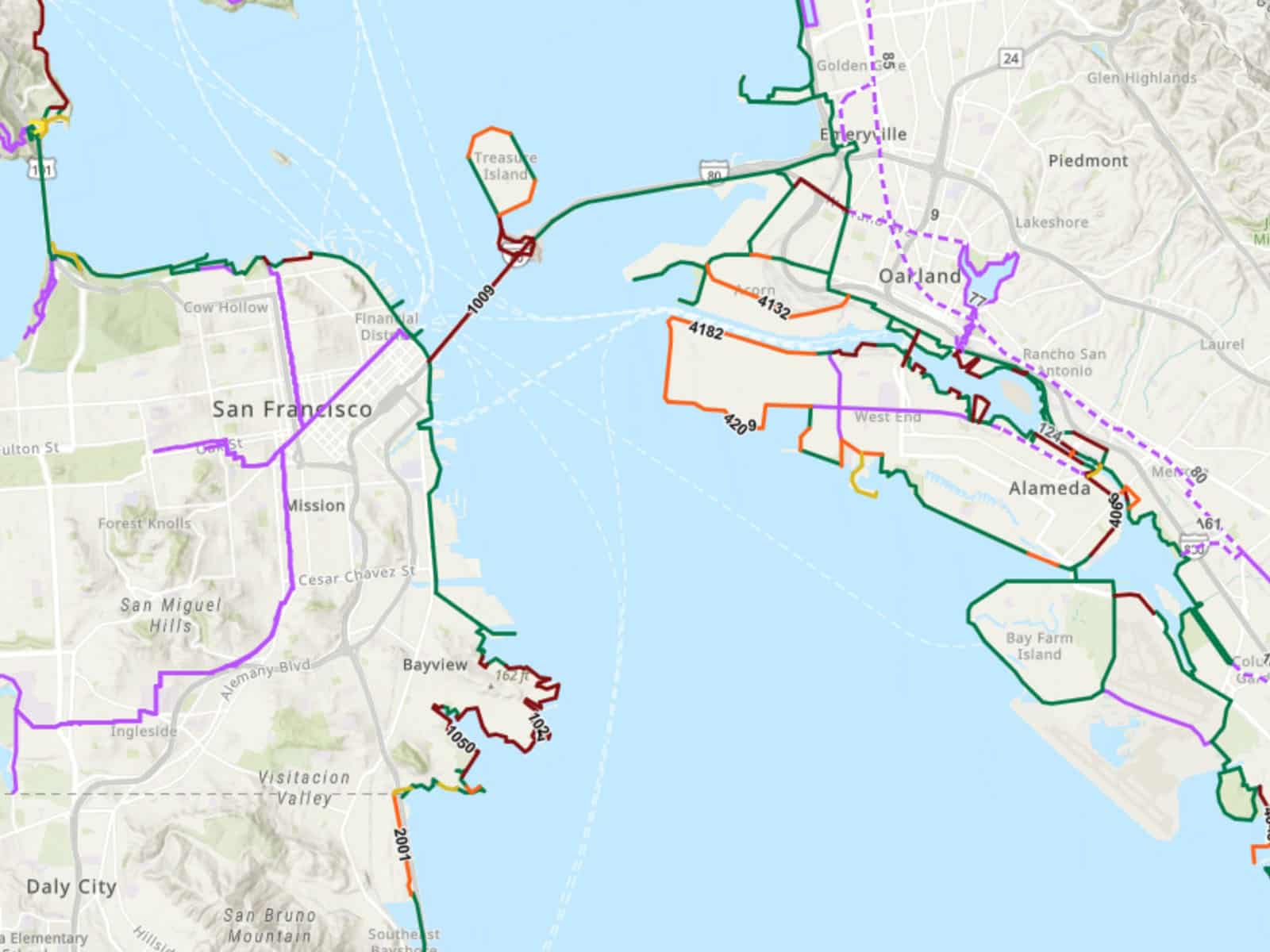
The Association of Bay Area Government (ABAG) and the Metropolitan Transportation Commission (MTC) released the Bay Trail Gap Closure Implementation Plan final report at the end of July, establishing prioritization criteria to rank the benefit of closing the remaining gaps in the San Francisco Bay Trail. According to MTC, the complete Bay Trail would comprise a total of 500 miles of trails that circle the San Francisco and San Pablo Bays. To date, more than 350 miles have been completed, the MTC report stated.
The final report, which is available online as a PDF , inventories the remaining gaps, identifies priorities and ranking of gaps for future investment, and develops cost estimates for closing those gaps. An interactive map , which can be enlarged to focus on specific areas, shows paved, dirt, and planned trails in Alameda, both on the main island and on Bay Farm Island. Those who have walked or biked around the island, especially near bay beaches and along the estuary, have traversed at least part of the Bay Trail, as signs along the trail denote.
The plan to eventually complete the Bay Trail network isn’t new, by any means. MTC and ABAG have been evaluating the Bay Trail network since 2005, when they published The San Francisco Bay Trail Project Gap Analysis Study . This study identified gaps in the trail network, scored and prioritized them, developed cost estimates for future construction, and presented an overall timeframe for completion of the full 500-mile vision of the Bay Trail.
The purpose of the current Implementation Plan is to build upon the 2005 analysis in order to identify and evaluate currently missing segments of the Bay Trail (trail gaps) and prioritize their construction in the remaining build-out and completion of the trail.
In this updated gap analysis study, a greater emphasis was placed on Equity Priority Community engagement and needs along with aligning the prioritization criteria with Plan Bay Area 2050.
Finally, the study updated cost estimates for closing gaps and conducted sea level rise analysis to begin the discussion about how certain segments of the Bay Trail may need to consider adaptation strategies in the future.
The multi-year implementation plan to complete the trail features engagement with a working group of more than 100 participants, with representation from all nine Bay Area counties. The working group includes staff from cities, counties, state, federal, transit and advocacy organizations, as well as partnership with nine community-based organizations that have engaged with members of the public in Equity Priority Communities.
The process reviewed the entire Bay Trail through the lens of the following priorities:
Center Equity Priority Communities in building out future segments of the Bay Trail.
Connect segments that create the longest continuous sections of trail.
Connect job centers to housing.
Increase access to transit-rich and connected communities.
Improve access to parks and open space.
Preserve the shoreline environment and access to the shoreline.
Consider impacts of sea level rise in the coming decades.
Get updates delivered to you daily. Free and customizable.
It’s essential to note our commitment to transparency:
Our Terms of Use acknowledge that our services may not always be error-free, and our Community Standards emphasize our discretion in enforcing policies. As a platform hosting over 100,000 pieces of content published daily, we cannot pre-vet content, but we strive to foster a dynamic environment for free expression and robust discourse through safety guardrails of human and AI moderation.
 Most Popular
Comments / 0