Fears of dangerous air quality were raised in middle America Tuesday as a thick cloud of wildfire smoke descended onto multiple states and Canada.
The air quality in North Dakota, eastern Montana, eastern Wyoming and northeastern Colorado, where the smoke appeared the thickest, reached concerning levels as the sun appeared to glow orange and red. Denver air quality quickly deteriorated as levels were "poor" Tuesday morning but reached "unhealthy" before the afternoon, which put anyone who spends extended amounts of time outdoors at risk.
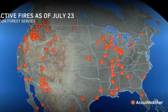
The smoke reportedly transcends central US as its true extent was visible from space, according to AccuWeather . Satellite images taken Tuesday morning showed the smoke had traveled far south to Texas and east to Michigan and Ohio.
READ MORE: Enormous Canada wildfire burns in Alberta as evacuation ordered at Jasper National Park
READ MORE: California braces for 'life-threatening' heatwave as brutal map shows extent of urgent warnings

Air quality in the mentioned states were altered but not to the extent of the hazardous conditions recorded in the northern Plains. The source lies in the western US and Canada where a raging wildfire has produced massive blankets of smoke into the atmosphere over the last few days. Wind has propelled the thick clouds to spread across North America, including areas that are a few hundred miles away from the flames.
The affected areas should brace for continual smoke to come through for the next few days as forecasters predict the dangerous conditions will continue to expand across the northern US and most of Canada for several more days. The most concentrated smoke will likely come from eastern Oregon and eastern Washington into Minnesota and across the Canadian provinces of Alberta, Saskatchewan and Manitoba.
A few layers of smoke higher in the atmosphere could enter the Midwest, Northeast, Ontario and Quebec. Residents near the Jasper National Park in Alberta, which measures at 4,200 sq miles, along with nearby local municipality were issued evacuation orders due to the dangerous flame raging south of the town.
Fire and rescue officials of Williams Lake, British Columbia faced a fast-moving fire that broke out Sunday. Meanwhile in Washington state and Oregon, hot and windy weather has sparked several other fires.
Click here to follow the Mirror US on Google News to stay up to date with all the latest news, sports and entertainment stories

In a report by the climate non-profit First Street Foundation, researchers found that more than 25% of the US population regularly take in air that is considered "unhealthy" in terms of Environmental Protection Agency standards. That figure is predicted to be raised by more than half by 2050. Additionally, the worst days of air pollution, labeled "dangerous" or maroon under the EPA's system, will raise by 27%
Smokes that pours out of wildfires, which have punctuated 2024, is one of the factors driving this trend. The authors said wildfire smoke can do enough damage to the atmosphere to reverse "decades of policy-driven improvements in overall air quality."
 Most Popular
Comments / 0