Get updates delivered to you daily. Free and customizable.
News8000com WKBT News 8
Tropical Storm Francine is already strengthening in the Gulf of Mexico
By By Mary Gilbert, CNN Meteorologist,
8 hours ago
(CNN) — Tropical Storm Francine started strengthening in the Gulf of Mexico ahead of an expected hurricane strike on Louisiana and parts of the western Gulf Coast by midweek.
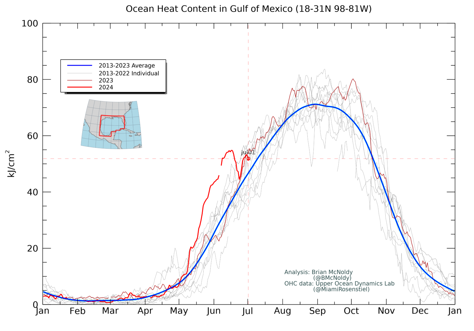
The storm was churning in the record-warm western Gulf of Mexico after forming late Monday morning a few hundred miles away from the Mexico-Texas border. Its wind speeds increased from 50 to 60 mph Monday afternoon – 14 mph shy of becoming a hurricane.
Flooding rainfall, strong winds and dangerous storm surge are likely this week along the western Gulf Coast as Francine continues to strengthen and tropical storm and hurricane watches have been issued in the region as a result.
Francine’s formation follows a rare quiet period in the Atlantic, with no named storms forming since Ernesto in mid-August during some of the busiest weeks of hurricane season.
While the storm is zeroing in on a possible Louisiana landfall, it’s still too early to pinpoint exactly where it could cross into the state and how strong it’ll be at the time. The storm could strengthen quickly over very warm water – a symptom of a planet warming from fossil fuel pollution – that essentially acts as jet fuel for tropical storms. It could also end up stronger than currently forecast.
Louisiana officials are already bracing for impact. Some parishes, including St. Mary and Terrebonne, started to close off floodgates and distribute sand bags Monday. Terrebonne Parish also declared a state of emergency , according to a news release.
Francine could become a hurricane by Tuesday night a few hundred miles east of the Texas coast and is expected to strengthen up until landfall on Wednesday evening.
Tropical storm-force winds could reach parts of far northeast Mexico and far southern Texas by Tuesday. Ahead of that, storm surge and rough surf could cause minor coastal flooding along the Mexican coastline early this week.
The storm’s worst rain and wind will likely begin by the morning Wednesday, but storm surge concerns will ramp up for the US as the system strengthens and as it nears landfall.
A storm surge watch was issued Monday for coastal areas of far eastern Texas through Louisiana and Mississippi. Parts of the central Louisiana coast could endure the worst storm surge, with levels potentially reaching up 10 feet above normal, particularly just before landfall.
Heavy rain will also be a serious threat, particularly in coastal areas of northwestern Mexico Monday. The system’s heavy rain could also begin in far southern Texas Monday before reaching more of the western Gulf Coast Tuesday.
Tropical downpours from the system will bring 4 to 8 inches of rain from far northeast Mexico to parts of the Texas coast and southern Louisiana this week. Totals could come close to a foot for areas stuck under persistent downpours. A more widespread 2 to 4 inches is likely across the region.
Texas will get most of its heavy rain early this week, but some of the most torrential conditions could hold off until late Tuesday night for Louisiana.
Tropical rainfall could lead to a “considerable” risk of flash flooding, according to the NHC.
A level 3 of 4 risk of flooding rainfall is in place Wednesday for much of Louisiana and parts of southern Mississippi, according to the Weather Prediction Center.
The system in the Gulf isn’t the only area of stormy weather that could cause tropical trouble.
Two other areas in the open Atlantic have a medium chance of developing in the next seven days, according to the NHC. Any possible tropical system from either is still days away from developing, so it’s far too early to speculate on where they could end up.
CNN Meteorologists Gene Norman, Elisa Raffa, Allison Chinchar and CNN’s Ashley R. Williams contributed to this report.
An infrared satellite image shows Potential Tropical Cyclone Six churning in the western Gulf of Mexico early Monday morning.
Texas will get most of its heavy rain early this week, but some of the most torrential conditions could hold off until late Tuesday night for Louisiana.
Get updates delivered to you daily. Free and customizable.
It’s essential to note our commitment to transparency:
Our Terms of Use acknowledge that our services may not always be error-free, and our Community Standards emphasize our discretion in enforcing policies. As a platform hosting over 100,000 pieces of content published daily, we cannot pre-vet content, but we strive to foster a dynamic environment for free expression and robust discourse through safety guardrails of human and AI moderation.


 Local News
Comments / 0