Get updates delivered to you daily. Free and customizable.
The Maine Monitor
In Wells, a ghost forest rises
By Kate Cough,
2 days ago
User-posted content
This story is part of a series on marshes in Maine co-published with the Portland Press Herald.
WELLS — At a distance the trees are eerie — leafless in August, tangled with broken branches, bark drained of color. They ring the edges of the marsh in stands between Laudholm Beach and the marsh upland.
“We call it a ghost forest,” said Susan Adamowicz, a biologist with the U.S Fish and Wildlife Service who has been studying marshes for decades.
As the ocean rises, she said, it creeps farther into the watershed, killing trees whose roots cannot tolerate the salty water or higher groundwater.
“It’s a sign of marsh migration,” said Adamowicz, “and is a natural response to climate change.”
Trees at the woodland edge like red pines or maples usually go first; with more inland trees — ash and birch and oak — hanging on longer.
Ideally, trees are replaced by the tufted saltwater grasses of the high marsh, but there’s no guarantee, as towering invasive reed Phragmites can crowd out native marsh grasses.
Dead trees known as ghost trees stand at the edge of the Wells Reserve marsh in Wells. As higher water levels occur in the marsh, the trees, whose roots can't tolerate salty water or higher groundwater levels, are killed. Photo by Gregory Rec of the Portland Press Herald.
Walking the sun-dappled trails of the Wells Reserve on a mild summer day, past stands of swamp maple and quaking aspen, surrounded by birdsong, it is hard to imagine that children who wander these paths today may live to see them become mud flats, or even open ocean.
Scientists have been warning about this possibility for years. A 2014 report, produced in part by researchers at the Reserve, predicts that sea level rise will fully submerge the Reserve’s estuarine lands by the end of the century and force marshy areas of the Rachel Carson National Wildlife Refuge to migrate inland.
“In the shorter term,” researchers wrote, “it is unclear whether Wells’ marshes will have room to migrate upland, and whether they will be able to migrate quickly enough.”
Residents have seen vivid examples of what it might look like in recent months, with back-to-back storms, coupled with high tides and winds from the southeast, that broke historical water levels for Wells Harbor.
Men carry kayaks along a boardwalk at the Wells Reserve to embark on a paddling excursion on the Little River through the reserve in October 2023. Photo by Gregory Rec of the Portland Press Herald.
A popular overlook and boardwalk on the Reserve were flooded and closed for weeks. Stones were strewn across roadways. Concrete seawalls in front of homes shattered under the waves. Acres of marshland were underwater, a glimpse of what the future might bring.
“Eventually they'll be flooded more often than they can tolerate and that will lead to vegetation die off, deterioration of the marsh peat, and then eventually a conversion to bare mud flats,” said Jacob Aman, who serves as stewardship director of the reserve, where he has worked since 2008.
The Wells Reserve, one of 30 designated national estuarine reserves nationwide, is unusual among marshes of the Maine coast.
It is fronted by sandy beach, rather than rocky ledge, which provides shelter from the wind and waves. Its meadows transition from narrow stands of smooth cordgrass at the seaward edge to salt marsh hay, accompanied by black rush, glasswort and sea lavender. Switchgrass, elder and seaside goldenrod grow at the upland border.
It is also bookended by development, with the resorts and cottages of Drakes Island to the southeast and the busy Route 1 thoroughfare to the north, a phenomenon researchers refer to as “coastal squeeze.”
This aerial image of Drake’s Island in Wells shows residential development between the Wells Reserve marsh and the ocean. The marsh is bookended by development between oceanfront housing and resort developments along Route 1. The development limits the areas where marshes can migrate to as water levels rise. Photo by Gregory Rec of the Portland Press Herald.
Aman and his colleagues have been working to find and preserve places for the marsh to migrate, but there’s very little room. “Unfortunately a lot of our adjacent areas around our marshes are highly developed.”
Even if they are able to identify a willing landowner and a suitable plot, the price in one of the state’s hottest housing markets is often insurmountable.
“When an organization is trying to conserve land they have to offer fair market value for it, and prices have gone up significantly,” said Aman. “It’s making the work of land conservation much more challenging.”
Dan Salvucci, whose property backs up to the marsh, said the January storms, though they wreaked havoc on many houses in the neighborhood, have done little to dampen the real estate market or change the conversation in the area. Several nearby homes — including one whose entire first floor flooded during the storms — have sold since January, said Salvucci.
“Everybody’s excited for the summer — they’re all dying to go to the beach. Nobody really talks about the storms.”
Dan Salvucci walks back to his home along a mud-covered Days Lane in Wells after storm surge tides receded on January 13, 2024. Salvucci lives right on the edge of the Rachel Carson National Wildlife Refuge and the water came up about four feet around his house, topping the hood of his car which he had parked on a high ground. He ended up losing a generator and lawn mower that were in a shed that was flooded and his car was irreparably damaged because of the high water. Photo by Gregory Rec of the Portland Press Herald.
Where they can’t give it space to move, conservationists are focused on making the marsh as healthy as possible so it has a chance to trap sediment, build up the surface and keep pace with rising seas. That’s the less glamorous work of widening culverts and raising roads — anything that restricts water flow throughout the marsh.
There’s a lot of state and federal money available for climate resiliency projects at the moment, said Aman, much of it aimed at preserving coastal wetlands.
The town of Wells was recently awarded roughly $2.8 million from the Bipartisan Infrastructure Law and Inflation Reduction Act, money that will go toward the conservation of 18 acres of coastal marshland and a new bridge to Drakes Island, a low-lying neighborhood surrounded by marsh and dunes on either side that has seen frequent devastating floods in recent years.
Around half of the conserved area is tidal wetlands, and the rest is either freshwater wetlands or upland that are expected to become tidal by the year 2100 if seas rise 3.9 feet.
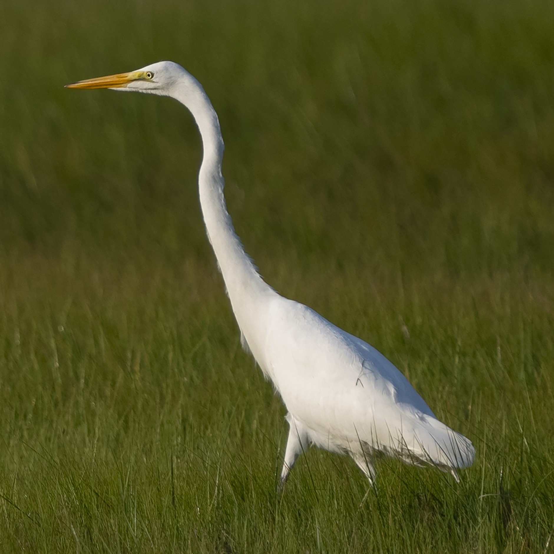
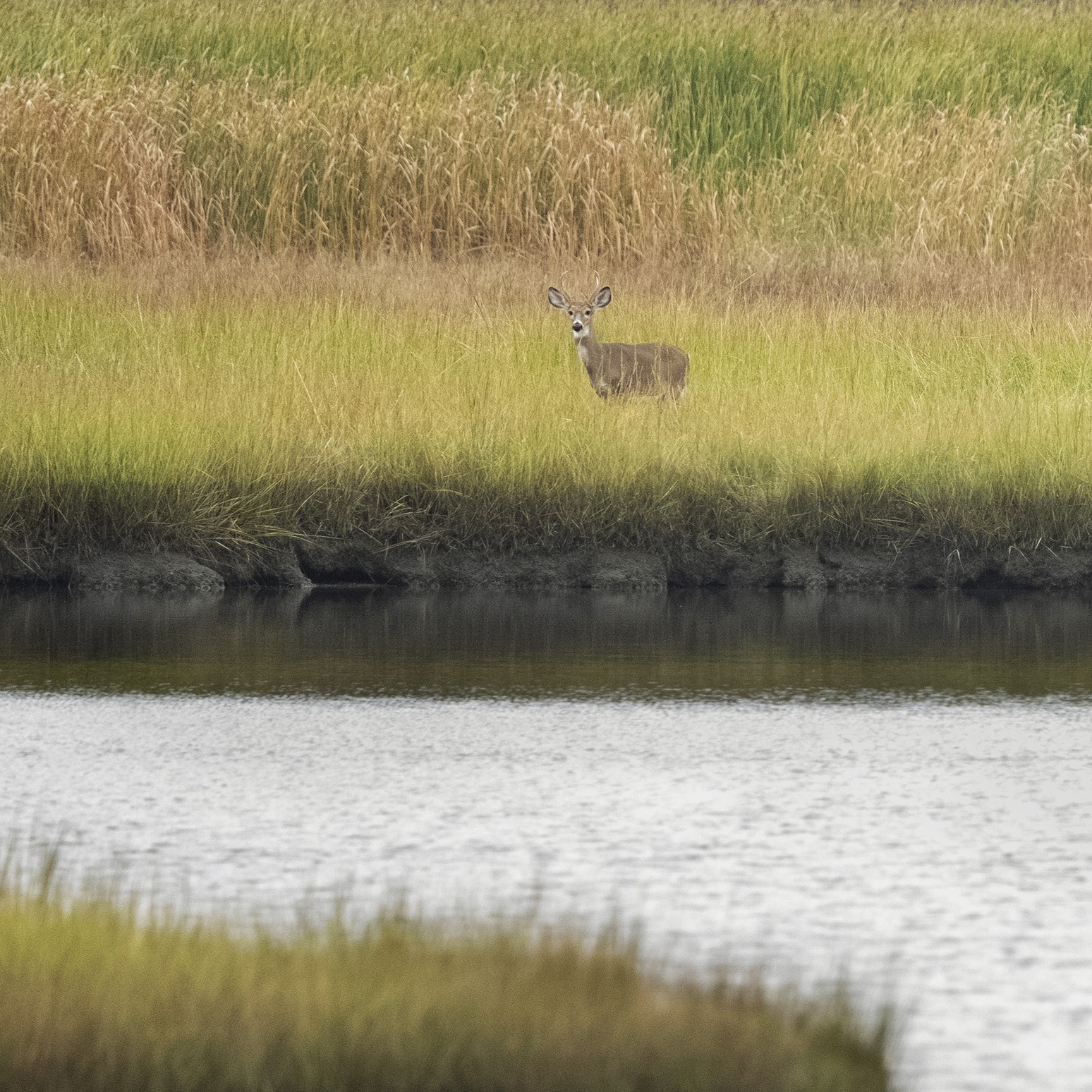
On the left, a great egret forages for food in the Wells Reserve marsh. On the right, a deer pauses while feeding in marsh at the Wells Reserve. Photos by Gregory Rec of the Portland Press Herald.
The funds were part of a larger grant that awarded money to coastal restoration and conservation projects around the state, a growing recognition of the importance of coastal marshland as a critical component in mitigating rising seas.
“The Drakes Island project represents the best of what the Bipartisan Infrastructure Law has to offer Maine and the nation,” Paul Dest, Executive Director of the Wells Reserve, said in announcing the money.
“It will construct a new bridge that should better weather future rising seas and storms, develop a plan to restore tidal habitats for a range of wildlife species, and protect a beautiful keystone parcel that connects to a landscape of conservation lands in one of Maine’s fastest growing communities.”
Drakes Island, which is fronted by a seawall on the beach with little natural dune system, has little protection from the worst of the wind and waves. A single road, Drakes Island Road, is the only reliable way to get on or off the island or to the town-owned beach and parking areas.
Jacob Aman, stewardship director at the Wells National Estuarine Research Reserve, explains how marsh grasses change as water levels rise in the marsh. Photo by Gregory Rec of the Portland Press Herald.
The money is not entirely a panacea, however, said Aman. Organizations that are able to raise funds for their plans often face another hurdle: finding a contractor in the state’s most rapidly developing region who can follow through on the work in the time allotted.
“We need engineers, we need construction companies. Because development is at an all-time high, it’s really hard to bid out these projects,” said Aman. “These construction companies have all the work they need.”
The result is a race against time and tides. In many places, the marsh will lose.
“We have seen that our marshes are sort of keeping up with sea level rise. But it’s very, very close,” said Aman. “As the rates increase — as they’re predicted to do — we don’t expect the marshes will be able to keep up.”
Get updates delivered to you daily. Free and customizable.
It’s essential to note our commitment to transparency:
Our Terms of Use acknowledge that our services may not always be error-free, and our Community Standards emphasize our discretion in enforcing policies. As a platform hosting over 100,000 pieces of content published daily, we cannot pre-vet content, but we strive to foster a dynamic environment for free expression and robust discourse through safety guardrails of human and AI moderation.


 Most Popular
Comments / 0